Geolocate

Fikkal topographic map

Click on the map to display elevation.

About this map

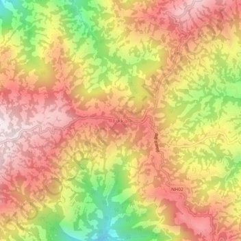
Name: Fikkal topographic map, elevation, terrain.

Location: Fikkal, Suryodaya, Ilam, Koshi Province, 57312, Nepal (26.87521 88.04615 26.91521 88.08615)

Average elevation: 1,449 m

Minimum elevation: 1,050 m

Maximum elevation: 1,723 m

Other topographic maps

Click on a map to view its topography, its elevation and its terrain.

Sandakpur

Nepal > Koshi Province > Ilam

Average elevation: 2,191 m

Deumai

Nepal > Koshi Province > Ilam

Average elevation: 1,232 m

Jogmai

Nepal > Koshi Province > Ilam

Average elevation: 1,044 m

Suryodaya

Nepal > Koshi Province > Ilam

Average elevation: 1,313 m

Sandakpur

Nepal > Koshi Province > Ilam

Average elevation: 2,191 m

Rong-04

Nepal > Koshi Province > Ilam

Average elevation: 561 m

Gear up for your next adventure:

🧴Bear Spray Holster - Quick-access carry for essential Canadian wilderness safety
Camping Tent - Weather-resistant tents suitable for 2 to 6 people
🔋Lithium AA Batteries - Long-lasting power that performs in extreme cold
🔭Compact Binoculars - Lightweight optics for scouting trails and wildlife
🥾Hiking Shorts - Breathable shorts suitable for summer hikes

As an Amazon Associate, this site earns from qualifying purchases at no extra cost to you.