Geolocate

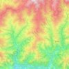
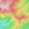
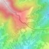
Jogmai topographic map

Click on the map to display elevation.

About this map

Name: Jogmai topographic map, elevation, terrain.

Location: Jogmai, Maljogmai-03, Maljogmai, Ilam, Koshi Province, 57304, Nepal (26.90993 88.01366 26.91039 88.01434)

Average elevation: 1,044 m

Minimum elevation: 682 m

Maximum elevation: 1,493 m

Other topographic maps

Click on a map to view its topography, its elevation and its terrain.
Fikkal

Nepal > Koshi Province > Ilam

Average elevation: 1,449 m

Deumai

Nepal > Koshi Province > Ilam

Average elevation: 1,232 m

Suryodaya

Nepal > Koshi Province > Ilam

Average elevation: 1,313 m

Rong-04

Nepal > Koshi Province > Ilam

Average elevation: 561 m

Sandakpur

Nepal > Koshi Province > Ilam

Average elevation: 2,191 m

Sandakpur

Nepal > Koshi Province > Ilam

Average elevation: 2,191 m

Tumling

Nepal > Koshi Province > Ilam

Average elevation: 2,759 m

Bikeybhanjan

Nepal > Koshi Province > Ilam

Average elevation: 2,982 m

Chitrey

Nepal > Koshi Province > Ilam

Average elevation: 2,101 m

Gear up for your next adventure:

🔭Outdoor Binoculars - Lightweight binoculars for birdwatching and hiking
🩹Compact First Aid Kit - Pre-packed essentials for common trail injuries
🧊Portable Cooler - Keep food and drinks cold during outdoor adventures
🧭GPS Outdoor Watch - Smart watch for navigation and fitness tracking in nature
💡Portable Camping Lamp - Rechargeable lamp for campsite lighting

As an Amazon Associate, this site earns from qualifying purchases at no extra cost to you.