Geolocate

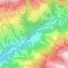
Sandakpur topographic map

Click on the map to display elevation.

About this map

Name: Sandakpur topographic map, elevation, terrain.

Location: Sandakpur, Ilam, Koshi Province, 36698, Nepal (26.98796 87.86017 27.10640 88.04967)

Average elevation: 2,191 m

Minimum elevation: 831 m

Maximum elevation: 3,615 m

Other topographic maps

Click on a map to view its topography, its elevation and its terrain.

Fikkal

Nepal > Koshi Province > Ilam

Average elevation: 1,449 m

Jogmai

Nepal > Koshi Province > Ilam

Average elevation: 1,044 m

Tumling

Nepal > Koshi Province > Ilam

Average elevation: 2,759 m

Bikeybhanjan

Nepal > Koshi Province > Ilam

Average elevation: 2,982 m

Chitrey

Nepal > Koshi Province > Ilam

Average elevation: 2,101 m

Gear up for your next adventure:

🛏️Sleeping Bag - Warm and compact sleeping bags for outdoor camping
🧶550 Survival Paracord - Versatile utility cord for emergency repairs and rigging
🧥Packable Rain Jacket - Breathable waterproof layer for unpredictable weather
🧥Thermal Layer - Insulating layer for cold outdoor conditions
⛺Bushcraft Tarp - Versatile emergency shelter or gear protection

As an Amazon Associate, this site earns from qualifying purchases at no extra cost to you.