Geolocate

Renfrew topographic map

Click on the map to display elevation.

About this map

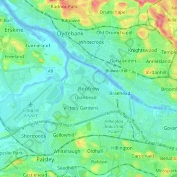
Name: Renfrew topographic map, elevation, terrain.

Location: Renfrew, Renfrewshire, Scotland, PA4 8TU, United Kingdom (55.83757 -4.42888 55.91757 -4.34888)

Average elevation: 16 m

Minimum elevation: -7 m

Maximum elevation: 75 m

Other topographic maps

Click on a map to view its topography, its elevation and its terrain.

River Cart

United Kingdom > Scotland > Renfrewshire > Renfrew

Average elevation: 6 m

Gear up for your next adventure:

Lightweight Camping Tent - Portable shelter optimized for Canadian backcountry camping
🗺️Topographic Maps - Detailed maps to explore trails, mountains, and wilderness areas
🧰Emergency Multi-Tool - Compact multi-tool for outdoor survival
💧Hydration Pack - Hands-free hydration system for long hikes
🚲MTB Frame Bag - Carry tools and maps directly on your bicycle frame

As an Amazon Associate, this site earns from qualifying purchases at no extra cost to you.