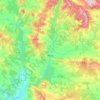
Aguja Sur Rusell topographic map
Click on the map to display elevation.
About this map

Name: Aguja Sur Rusell topographic map, elevation, terrain.
Location: Aguja Sur Rusell, Ribagorza, Huesca, Aragón, 22487, España (42.61599 0.67238 42.61609 0.67248)
Average elevation: 2,768 m
Minimum elevation: 2,306 m
Maximum elevation: 3,353 m
Other topographic maps
Click on a map to view its topography, its elevation and its terrain.