Geolocate

Graus topographic map

Click on the map to display elevation.

About this map

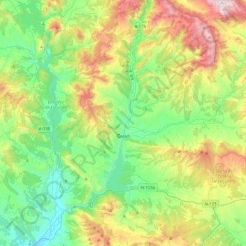
Name: Graus topographic map, elevation, terrain.

Location: Graus, La Ribagorza, Huesca, Aragon, 22430, Spain (42.05759 0.25895 42.35155 0.51567)

Average elevation: 710 m

Minimum elevation: 313 m

Maximum elevation: 1,541 m

Gear up for your next adventure:

🥤Collapsible Travel Cup - Saves space and weight in your mess kit
🥾Trail Running Shoes - Lightweight and durable shoes for trail running
🧰Emergency Multi-Tool - Compact multi-tool for outdoor survival
🎒Hiking Backpack - Lightweight and ergonomic backpacks for day hikes or multi-day treks
🛶Kayak Accessories - Essential gear for safe and fun kayaking adventures

As an Amazon Associate, this site earns from qualifying purchases at no extra cost to you.