Geolocate

Villanova topographic map

Click on the map to display elevation.

About this map
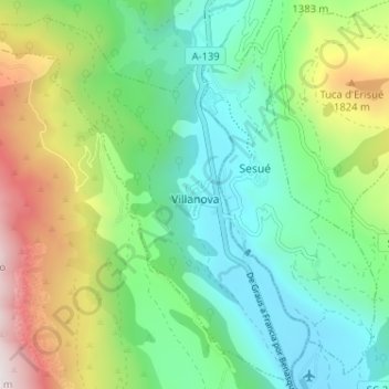
Name: Villanova topographic map, elevation, terrain.

Location: Villanova, La Ribagorza, Huesca, Aragon, Spain (42.52493 0.41666 42.57095 0.48100)

Average elevation: 1,346 m

Minimum elevation: 906 m

Maximum elevation: 2,313 m

Other topographic maps

Click on a map to view its topography, its elevation and its terrain.

Noales

Spain > Aragon > La Ribagorza > Montanuy

Average elevation: 1,217 m

Forcat

Spain > Aragon > La Ribagorza > Montanuy

Average elevation: 1,398 m

Gear up for your next adventure:

🧭Orienteering Kit - Tools for map reading and navigation in the wild
🧥Insulated Jacket - Keep warm in cold outdoor conditions
🧢Hiking Sun Hat - Wide-brimmed protection for exposed mountain ridges
🦶Hiking Shoe Insoles - Added support for high arches and long days on feet
🧦Hiking Liner Socks - Thin base layer to prevent friction and blisters

As an Amazon Associate, this site earns from qualifying purchases at no extra cost to you.