Geolocate

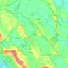
Viadana topographic map

Click on the map to display elevation.

About this map

Name: Viadana topographic map, elevation, terrain.

Location: Viadana, Mantua, Lombardy, 46019, Italy (44.91027 10.46719 45.05494 10.71074)

Average elevation: 23 m

Minimum elevation: 16 m

Maximum elevation: 37 m

Other topographic maps

Click on a map to view its topography, its elevation and its terrain.

Astore

Italy > Lombardy > Mantua > Castiglione delle Stiviere

Average elevation: 130 m

Cicognara

Italy > Lombardy > Mantua > Viadana

Average elevation: 26 m

Montanara

Italy > Lombardy > Mantua > Curtatone

Average elevation: 24 m

Astore

Italy > Lombardy > Mantua > Castiglione delle Stiviere

Average elevation: 130 m

Marengo

Italy > Lombardy > Mantua

Average elevation: 39 m

Po

Italy > Lombardy > Mantua > Moglia > Bugno

Average elevation: 12 m

Torriana

Italy > Lombardy > Mantua

Average elevation: 15 m

Corte Tesorino

Italy > Lombardy > Mantua > Rivalta sul Mincio

Average elevation: 24 m

Gear up for your next adventure:

📷Outdoor Action Camera - Capture high-elevation views and rugged adventures
🧦Hiking Liner Socks - Thin base layer to prevent friction and blisters
🥾Hiking Gaiters - Protect legs and shoes from mud, snow, and debris
🛶Canoe Life Vest - Safety vest for water sports
🗺️Topographic Maps - Detailed maps to explore trails, mountains, and wilderness areas

As an Amazon Associate, this site earns from qualifying purchases at no extra cost to you.