Geolocate

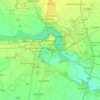
Torriana topographic map

Click on the map to display elevation.

About this map

Name: Torriana topographic map, elevation, terrain.

Location: Torriana, Serravalle a Po, Mantua, Lombardy, 46030, Italy (45.04653 11.06198 45.08653 11.10198)

Average elevation: 15 m

Minimum elevation: 9 m

Maximum elevation: 27 m

Other topographic maps

Click on a map to view its topography, its elevation and its terrain.

Castel d'Ario

Italy > Lombardy > Mantua

Average elevation: 21 m

Mantua

Italy > Lombardy > Mantua

Average elevation: 22 m

Mantua

Italy > Lombardy > Mantua

Average elevation: 22 m

Viadana

Italy > Lombardy > Mantua

Average elevation: 23 m

Solferino

Italy > Lombardy > Mantua

The municipal territory, extending for 13.08 km2, is part of the Morainic amphitheatre of Lake Garda, located a few kilometres to the north. The altitude at the town hall is 124 m above sea level. Not far away also lies the province of Verona, with the towns of Peschiera del Garda and Valeggio sul Mincio, only…

Average elevation: 119 m

Bagnolo San Vito

Italy > Lombardy > Mantua

Average elevation: 18 m

Moglia

Italy > Lombardy > Mantua

Average elevation: 17 m

Po

Italy > Lombardy > Mantua > Moglia > Bugno

Average elevation: 12 m

Volta Mantovana

Italy > Lombardy > Mantua

Average elevation: 73 m

Gonzaga

Italy > Lombardy > Mantua

Average elevation: 18 m

Corte Tesorino

Italy > Lombardy > Mantua > Rivalta sul Mincio

Average elevation: 24 m

Gear up for your next adventure:

🧊Insulated Water Bottle - Keeps drinks cold in summer and prevents freezing in winter
💧Hydration Pack - Hands-free hydration system for long hikes
🛌Down Sleeping Bag - Superior warmth-to-weight ratio for cold nights
🥾Approach Boots - Comfortable boots for hiking and climbing approaches
🛰️Satellite Messenger - Emergency communication for areas with no cell service

As an Amazon Associate, this site earns from qualifying purchases at no extra cost to you.