Geolocate

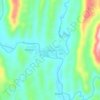
Totora topographic map

Click on the map to display elevation.

About this map

Name: Totora topographic map, elevation, terrain.

Location: Totora, Province of Rodríguez de Mendoza, Amazonas, Peru (-6.51867 -77.49738 -6.46839 -77.43960)

Average elevation: 1,820 m

Minimum elevation: 1,639 m

Maximum elevation: 2,351 m

Other topographic maps

Click on a map to view its topography, its elevation and its terrain.

Plazapampa

Peru > Amazonas > Balsas

Average elevation: 2,448 m

Membrillo

Peru > Amazonas > Pisuquía

Average elevation: 2,163 m

Florida

Peru > Amazonas > Florida

Average elevation: 2,356 m

Cuchapampa

Peru > Amazonas > Tingo

Average elevation: 2,681 m

Department of Amazonas

Peru > Amazonas

Average elevation: 928 m

Huampami

Peru > Amazonas > El Cenepa

Average elevation: 290 m

Bichanak

Peru > Amazonas > Imaza

Average elevation: 413 m

Casual

Peru > Amazonas > Bagua

Average elevation: 440 m

Espital

Peru > Amazonas

Average elevation: 910 m

Gear up for your next adventure:

🥾Trail Hiking Boots - Supportive boots for rough trails
🧤Thermal Hiking Gloves - Grip-enhanced gloves for cold-weather altitude trekking
🧥Fleece Jacket - Warm and lightweight jacket for layering
💡Solar Camping Lamp - Eco-friendly lighting for campsites
🧤Insulated Winter Gloves - Heavy-duty protection for sub-zero Canadian adventures

As an Amazon Associate, this site earns from qualifying purchases at no extra cost to you.