Geolocate

Bichanak topographic map

Click on the map to display elevation.

About this map

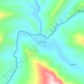
Name: Bichanak topographic map, elevation, terrain.

Location: Bichanak, Imaza, Province of Bagua, Amazonas, Peru (-4.95901 -78.21700 -4.91901 -78.17700)

Average elevation: 413 m

Minimum elevation: 277 m

Maximum elevation: 883 m

Gear up for your next adventure:

🪑Insulated Seat Pad - Protect your seat from cold rocks and wet logs
👖Convertible Hiking Pants - Zip-off legs to adapt to changing weather conditions
🕶️Polarized Sunglasses - Protect your eyes with durable polarized lenses
🧭GPS Handheld Device - Reliable GPS navigation for outdoor adventures
🚲MTB Frame Bag - Carry tools and maps directly on your bicycle frame

As an Amazon Associate, this site earns from qualifying purchases at no extra cost to you.