Geolocate

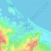
Greerton topographic map

Click on the map to display elevation.

About this map

Name: Greerton topographic map, elevation, terrain.

Location: Greerton, Tauranga City, Bay of Plenty, 3112, New Zealand (-37.76070 176.11090 -37.70368 176.16107)

Average elevation: 29 m

Minimum elevation: -1 m

Maximum elevation: 137 m

Other topographic maps

Click on a map to view its topography, its elevation and its terrain.
Tauranga

New Zealand > Bay of Plenty > Tauranga City

Average elevation: 66 m

Mangatawa

New Zealand > Bay of Plenty > Tauranga City > Papamoa

Average elevation: 18 m

Tauranga

New Zealand > Bay of Plenty > Tauranga City

Average elevation: 63 m

Greerton

New Zealand > Bay of Plenty > Tauranga City

Average elevation: 31 m

Tauranga

New Zealand > Bay of Plenty > Tauranga City

Average elevation: 66 m

Tauranga

New Zealand > Bay of Plenty > Tauranga City

Average elevation: 66 m

Tauranga

New Zealand > Bay of Plenty > Tauranga City

Average elevation: 66 m

Tauranga

New Zealand > Bay of Plenty > Tauranga City

Average elevation: 66 m

Gear up for your next adventure:

⛺Family Camping Tent - Spacious tent suitable for family camping trips
🛶Canoe Life Vest - Safety vest for water sports
🔥Emergency Fire Starter - Reliable ignition source for all weather conditions
🧢Outdoor Visor - Breathable visor for sunny hikes
🌡️Emergency Mylar Blankets - Compact thermal protection for unexpected nights outdoors

As an Amazon Associate, this site earns from qualifying purchases at no extra cost to you.