
Romblon topographic map
Interactive map
Click on the map to display elevation.
About this map
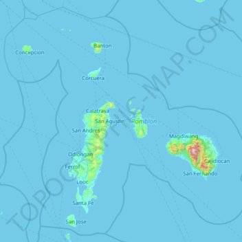
Name: Romblon topographic map, elevation, terrain.
Location: Romblon, Mimaropa, Philippinen (11.99120 121.58761 13.14084 122.84186)
Average elevation: 15 m
Minimum elevation: 0 m
Maximum elevation: 1,971 m
Other topographic maps
Click on a map to view its topography, its elevation and its terrain.
Tablas Island
Tablas Island, Looc, Romblon, Mimaropa, Philippinen
Average elevation: 26 m