Geolocate

Torsa topographic map

Click on the map to display elevation.

About this map

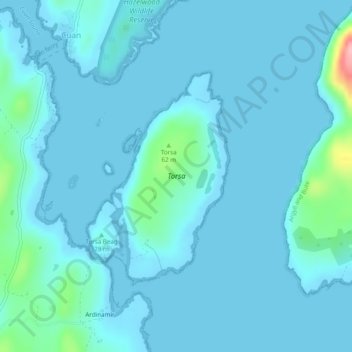
Name: Torsa topographic map, elevation, terrain.

Location: Torsa, Ardinamir, Argyll and Bute, Scotland, United Kingdom (56.24997 -5.62629 56.26581 -5.60703)

Average elevation: 12 m

Minimum elevation: 0 m

Maximum elevation: 141 m

Gear up for your next adventure:

🥾Approach Boots - Comfortable boots for hiking and climbing approaches
🐕Hiking Dog Pack - Let your canine companion carry their own water and food
🛏️Sleeping Bag - Warm and compact sleeping bags for outdoor camping
📷Outdoor Action Camera - Capture high-elevation views and rugged adventures
🛶Waterproof Dry Bags - Keep electronics and clothes dry during river crossings

As an Amazon Associate, this site earns from qualifying purchases at no extra cost to you.