
Spandau topographic map
Interactive map
Click on the map to display elevation.
About this map
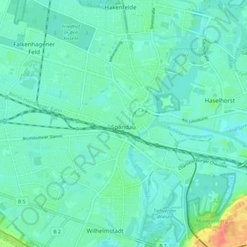
Name: Spandau topographic map, elevation, terrain.
Location: Spandau, Berlin, Germany (52.51750 13.16238 52.55552 13.24772)
Average elevation: 36 m
Minimum elevation: 26 m
Maximum elevation: 78 m
Other topographic maps
Click on a map to view its topography, its elevation and its terrain.