Geolocate

Krausnick topographic map

Click on the map to display elevation.

About this map

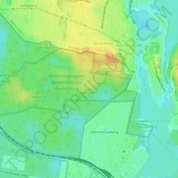
Name: Krausnick topographic map, elevation, terrain.

Location: Krausnick, Berlin, 15569, Germany (52.44339 13.74526 52.44349 13.74536)

Average elevation: 45 m

Minimum elevation: 31 m

Maximum elevation: 67 m

Other topographic maps

Click on a map to view its topography, its elevation and its terrain.

Ostsee

Germany > Berlin

Average elevation: 47 m

Gear up for your next adventure:

🔭Compact Binoculars - Lightweight optics for scouting trails and wildlife
💡Compact LED Flashlight - Powerful and portable flashlight for outdoor use
🥾Trail Hiking Boots - Supportive boots for rough trails
🥽Outdoor Goggles - Protective eyewear for outdoor activities
🥘Camping Cookware Set - Compact nesting pots and pans for trail cooking

As an Amazon Associate, this site earns from qualifying purchases at no extra cost to you.