Geolocate

Bluewater topographic map

Click on the map to display elevation.

About this map
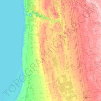
Name: Bluewater topographic map, elevation, terrain.

Location: Bluewater, Huron County, Southwestern Ontario, Ontario, Canada (43.33522 -81.74569 43.60553 -81.48432)

Average elevation: 237 m

Minimum elevation: 174 m

Maximum elevation: 316 m

Other topographic maps

Click on a map to view its topography, its elevation and its terrain.
Seaforth

Canada > Ontario > Huron County > Huron East > Seaforth

Average elevation: 312 m

Gear up for your next adventure:

🦟Insect Repellent - Keep mosquitoes and black flies away in wooded areas
🥾Waterproof Hiking Boots - Boots keeping your feet dry in wet conditions
🧣Evaporative Cooling Towel - Beat the heat during intense summer climbs
🧳Compression Sacks - Maximize space in your backpack by shrinking gear
🚲Handlebar Phone Mount - View topographic-map.com live while cycling

As an Amazon Associate, this site earns from qualifying purchases at no extra cost to you.