
Lusk topographic map
Click on the map to display elevation.
About this map
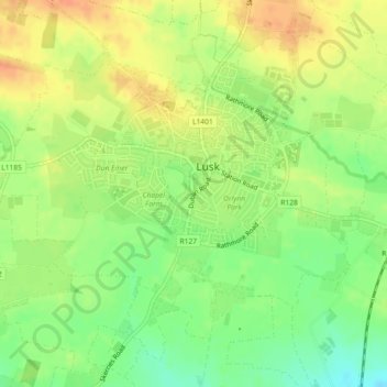
Name: Lusk topographic map, elevation, terrain.
Location: Lusk, Fingal, County Dublin, Leinster, Ireland (53.51449 -6.18336 53.53288 -6.15157)
Average elevation: 23 m
Minimum elevation: 1 m
Maximum elevation: 42 m
Other topographic maps
Click on a map to view its topography, its elevation and its terrain.
Swords
Ireland > County Dublin > Swords
The medieval town developed in a linear pattern along Main Street, in a roughly north-south direction. Swords has one of the best examples of this settlement pattern in the Dublin region. The round tower, 26m in height, is also an indicator of early Christian settlement. The Irish high king Brian Boru is said…
Average elevation: 28 m
Blanchardstown
Blanchardstown was a predominantly rural area, with a small village, in western County Dublin, alongside the neighbouring district of Castleknock. Both areas shared a common history until well into the 19th century, when their development diverged. In A Topographical Dictionary of Ireland, published in 1837,…
Average elevation: 61 m
Baldoyle
Ireland > County Dublin > Sutton
A description of Baldoyle from Lewis's Topographical Dictionary of Ireland (Dublin, 1837) gives a useful summary of what was then a substantial rural fishing village.
Average elevation: 2 m
Dundrum and Glencullen Dispensary District
Ireland > County Dublin > Ballyogan
Average elevation: 153 m
Lambay Island
Lambay Island is the largest island off the east coast of Ireland. It covers about 2.5 km2 (0.97 sq mi). The highest point – a hill known as Knockbane – rises to 126 m (413 ft). The island's high ground lies to the east and aside from Knockbane includes Heath Hill and Tinian Hill, and in the extreme…
Average elevation: 14 m
Swords
At the northern end of the street stands Swords Castle, 200m northeast of the ecclesiastical site, which was built in the early 13th century. A short distance north of the castle is the elevation known as Spittal Hill, where a hospital once stood.
Average elevation: 24 m
Castleknock
As the word Castle did not come into use in Ireland until Norman times we know that Castleknock is a name of comparatively recent origin. Documents from the 12th and 13th centuries refer to the place as Castrum Cnoc, simply Cnoc and also Chastel-cnoc or Castel-Cnoc. So it seems that the name Castleknock is…
Average elevation: 55 m