Geolocate

Järstad topographic map

Click on the map to display elevation.

About this map

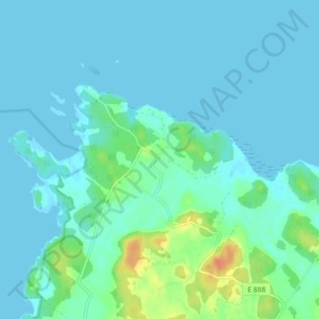
Name: Järstad topographic map, elevation, terrain.

Location: Järstad, Norrköpings kommun, Östergötland County, Sweden (58.60874 16.44067 58.64874 16.48067)

Average elevation: 6 m

Minimum elevation: -1 m

Maximum elevation: 37 m

Other topographic maps

Click on a map to view its topography, its elevation and its terrain.

Kinda kommun

Sweden > Östergötland County

Average elevation: 133 m

Nässja

Sweden > Östergötland County

Average elevation: 91 m

Navestad

Sweden > Östergötland County > Norrköping

Average elevation: 34 m

Vadstena

Sweden > Östergötland County

Average elevation: 98 m

Illern

Sweden > Östergötland County > Linköping

Average elevation: 72 m

Mjölby kommun

Sweden > Östergötland County

Average elevation: 123 m

Halgen

Sweden > Östergötland County

Average elevation: 88 m

Lindö

Sweden > Östergötland County > Lindö

Average elevation: 8 m

Järstad

Sweden > Östergötland County

Average elevation: 82 m

Boxholms kommun

Sweden > Östergötland County

Average elevation: 169 m

Gear up for your next adventure:

🥾Trail Hiking Socks - Comfortable socks to prevent blisters and fatigue
🦟Insect Repellent - Keep mosquitoes and black flies away in wooded areas
🔋Lithium AA Batteries - Long-lasting power that performs in extreme cold
🧥Ultralight Puffy Jacket - Maximum warmth that packs down to the size of an orange
🦶Anti-Blister Balm - Prevents friction and hotspots during long ascents

As an Amazon Associate, this site earns from qualifying purchases at no extra cost to you.