
Zinder Region topographic map
Interactive map
Click on the map to display elevation.
About this map
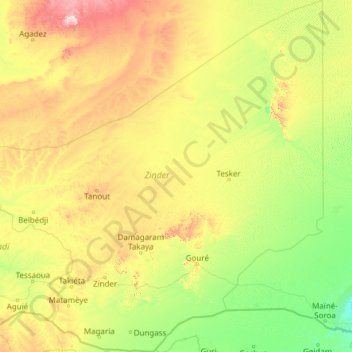
Name: Zinder Region topographic map, elevation, terrain.
Location: Zinder Region, Niger (12.80741 7.35444 17.49440 12.00280)
Average elevation: 440 m
Minimum elevation: 305 m
Maximum elevation: 1,082 m
Other topographic maps
Click on a map to view its topography, its elevation and its terrain.