Geolocate

Purmela topographic map

Click on the map to display elevation.

About this map

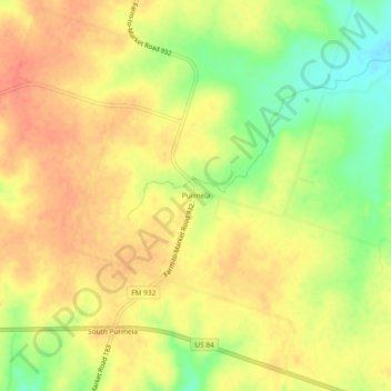
Name: Purmela topographic map, elevation, terrain.

Location: Purmela, Coryell County, Texas, 76566, United States (31.46377 -97.98225 31.50377 -97.94225)

Average elevation: 321 m

Minimum elevation: 291 m

Maximum elevation: 339 m

Other topographic maps

Click on a map to view its topography, its elevation and its terrain.

Oglesby

United States > Texas > Coryell County

Average elevation: 257 m

Copperas Cove

United States > Texas > Coryell County

Average elevation: 317 m

Evant

United States > Texas > Coryell County

Average elevation: 382 m

Copperas Cove

United States > Texas > Coryell County

Average elevation: 317 m

Gatesville

United States > Texas > Coryell County

Average elevation: 261 m

Gear up for your next adventure:

🥫Freeze-Dried Meals - Lightweight, high-calorie nutrition for multi-day treks
🎒Hiking Backpack - Lightweight and ergonomic backpacks for day hikes or multi-day treks
🥾Lightweight Hiking Boots - Boots for comfort and mobility on long hikes
🐕Hiking Dog Pack - Let your canine companion carry their own water and food
💡Solar Camping Lamp - Eco-friendly lighting for campsites

As an Amazon Associate, this site earns from qualifying purchases at no extra cost to you.