Geolocate

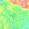
Muimenta topographic map

Click on the map to display elevation.

About this map

Name: Muimenta topographic map, elevation, terrain.

Location: Muimenta, Cospeito, Terra Chá, Lugo, Galicia, 27256, Spain (43.23309 -7.45137 43.27309 -7.41137)

Average elevation: 417 m

Minimum elevation: 405 m

Maximum elevation: 457 m

Other topographic maps

Click on a map to view its topography, its elevation and its terrain.

A Graña de Vilarente

Spain > Galicia > Terra Chá

Average elevation: 445 m

Castro de Rei

Spain > Galicia > Terra Chá

Castro de Rei is located in the comarca of the Terra Cha. This factor determines the most of their socioeconomic characteristics. Its average altitude is between 400 and 500 meters. In the east the terrain becomes more rugged due to its proximity to the eastern mountains. The elevation of the Montes dos…

Average elevation: 505 m

Muras

Spain > Galicia > Terra Chá > Muras

Average elevation: 553 m

Abadín

Spain > Galicia > Terra Chá

Abadín is situated in the north-east of Terra Chá. The municipality is crossed by the Serra do Xistral, the Cordal de Neda, and the rivers Labrada and Abadín. The mean elevation is of 500 m, and the highest point is Lombo Pequeno at 1015 m.

Average elevation: 547 m

Begonte

Spain > Galicia > Terra Chá

Average elevation: 454 m

Vilalba

Spain > Galicia > Terra Chá

Average elevation: 509 m

Vilapedre

Spain > Galicia > Terra Chá > Vilalba

Average elevation: 634 m

Momán

Spain > Galicia > Terra Chá

Average elevation: 404 m

Gear up for your next adventure:

🧊Insulated Water Bottle - Keeps drinks cold in summer and prevents freezing in winter
💧Hydration Bladder - Hands-free hydration solution for long treks
🔪Outdoor Multitool - Versatile tool for repairs and food prep in the wild
💡LED Camping Lantern - Illuminate your campsite with long-lasting lanterns
🥾Trail Running Boots - Durable shoes designed for trail running

As an Amazon Associate, this site earns from qualifying purchases at no extra cost to you.