Geolocate

Villa Rica topographic map

Click on the map to display elevation.

About this map
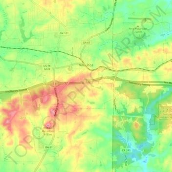
Name: Villa Rica topographic map, elevation, terrain.

Location: Villa Rica, Carroll County, Georgia, 30180, United States (33.68193 -84.97237 33.76000 -84.86267)

Average elevation: 338 m

Minimum elevation: 281 m

Maximum elevation: 410 m

Other topographic maps

Click on a map to view its topography, its elevation and its terrain.

Ithaca

United States > Georgia > Carroll County

Average elevation: 342 m

Gear up for your next adventure:

🛰️Satellite Messenger - Emergency communication for areas with no cell service
🛌Insulated Sleeping Pad - Critical thermal barrier between you and the cold ground
🥾Mountain Hiking Boots - High-traction boots for rocky terrain
🔭Compact Binoculars - Lightweight optics for scouting trails and wildlife
🔥Camping Stove - Portable stoves to cook outdoors with ease

As an Amazon Associate, this site earns from qualifying purchases at no extra cost to you.