Geolocate

Ithaca topographic map

Click on the map to display elevation.

About this map
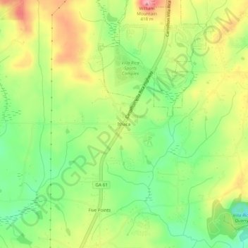
Name: Ithaca topographic map, elevation, terrain.

Location: Ithaca, Carroll County, Georgia, United States (33.66066 -84.96800 33.70066 -84.92800)

Average elevation: 342 m

Minimum elevation: 284 m

Maximum elevation: 410 m

Other topographic maps

Click on a map to view its topography, its elevation and its terrain.
Villa Rica

United States > Georgia > Carroll County

Average elevation: 338 m

Whitesburg

United States > Georgia > Carroll County

Average elevation: 249 m

Gear up for your next adventure:

🥾Waterproof Trail Shoes - Shoes designed to handle wet terrain
🕯️Camping Lantern - Illuminates your entire campsite with high-efficiency LEDs
🥾Trail Hiking Socks - Comfortable socks to prevent blisters and fatigue
🩹Moleskin Blister Pads - Direct protection for painful foot pressure points
🧦Crew Hiking Socks - Comfortable socks for long-distance hikes

As an Amazon Associate, this site earns from qualifying purchases at no extra cost to you.