Geolocate

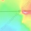
Shuanghu County topographic map

Click on the map to display elevation.

Shuanghu County

Shuanghu County (Chinese: 双湖县), also transliterated from Tibetan as Tsonyi County or Co Nyi County (Tibetan: མཚོ་གཉིས་རྫོང་།), is a county under the jurisdiction of the prefecture-level city of Nagqu, in the northernmost part of the Tibet Autonomous Region, China. It was formed in 2012, combining the territory of the former Shuanghu Special District (Chinese: 双湖特别区, Tibetan: མཚོ་གཉིས་དམིགས་བསལ་སྲིད་འཛིན་ཁུལ་) with the eastern half of Nyima County. Much of the county is within the Changtang area. Shuanghu is the highest county of China with an average elevation of more than 5,000 metres (16,000 ft), while its county seat is located at 4,920 metres (16,140 ft).

Wikipedia (CC-BY-SA 3.0)

About this map

Name: Shuanghu County topographic map, elevation, terrain.

Location: Shuanghu County, Nagqu City, Xizang, China (31.64274 86.06724 36.48407 90.37519)

Average elevation: 5,015 m

Minimum elevation: 4,465 m

Maximum elevation: 6,544 m

Other topographic maps

Click on a map to view its topography, its elevation and its terrain.

Rixung

China > Xizang > Chamdo City

Average elevation: 4,259 m

Everest Base Camp

China > Xizang > Tingri County > Tashi Dzom town

Average elevation: 5,377 m

Mount Kailash

China > Xizang > Purang County > Parga town

Mount Kailash (also Kailasa; Kangrinboqê or Gang Rinpoche; Tibetan: གངས་རིན་པོ་ཆེ; simplified Chinese: 冈仁波齐峰; traditional Chinese: 岡仁波齊峰; Sanskrit: कैलास, IAST: Kailāsa), is a mountain in the Ngari Prefecture, Tibet Autonomous Region of China. It has an…

Average elevation: 5,756 m

Gangqên

China > Xizang > Baqên County > Marru township

Average elevation: 4,521 m

Kardung

China > Xizang > Purang County > Purang

Average elevation: 5,098 m

Bangbu

China > Xizang > Lhari County > Lhari town

Average elevation: 4,840 m

Namcha Barwa

China > Xizang > Mainling City

Average elevation: 6,698 m

Bé

China > Xizang > Zayu County

Average elevation: 2,474 m

卡拉

China > Xizang > Bomê County > Yi'ong township

Average elevation: 3,779 m

Rinchen Bumpa

China > Xizang > Lhodrak County

Average elevation: 3,969 m

Tacai La

China > Xizang > Yadong County > Chomodoi township

Average elevation: 4,498 m

Senqiong La

China > Xizang > Yadong County > Chomodoi township

Average elevation: 4,358 m

Chidê

China > Xizang > Purang County > Purang

Average elevation: 3,986 m

Namcha Barwa

China > Xizang > Mainling City

Average elevation: 6,698 m

Chumbi Valley

China > Xizang > Yadong County > Xiayadong Township > Rinchengang

The valley is at an altitude of 3,000 m (9,800 ft), and being on the south side of the Himalayas, enjoys a wetter and more temperate climate than most of Tibet. The valley supports some vegetation in the form of the Eastern Himalayan broadleaf forests and transitions to the Eastern Himalayan alpine shrub and…

Average elevation: 3,076 m

Goinsar

China > Xizang > Nyalam County > Dram town

Average elevation: 2,421 m

Qoidên

China > Xizang > Chamdo City

Average elevation: 3,962 m

Dê’gyiling

China > Xizang > Ngamring County > Kagar town

Average elevation: 4,637 m

Raorang

China > Xizang > Lhuntse County > Doyul township

Average elevation: 3,609 m

Nai

China > Xizang > Tingri County > Shelkar town

Average elevation: 4,422 m

Nyingchi

China > Xizang

Average elevation: 4,035 m

Lhakü

China > Xizang > Dinggyê County > Qab township

Average elevation: 4,298 m

Sulu La

China > Xizang > Dinggyê County > Zhêntang

Average elevation: 4,161 m

Torsa Nala

China > Xizang > Yadong County > Xiayadong Township

Average elevation: 2,980 m

Kunlun Mountains

China > Xizang > Rutog County > Dongru township

Average elevation: 6,188 m

Mount Kailash

China > Xizang > Purang County > Parga town

Mount Kailash (also Kailasa, Gang Tise and Gang Rinpoche or Kangrinboqê) is a mountain in Ngari Prefecture, Tibet Autonomous Region of China. It lies in the Gangdise Shan mountain range of the Transhimalaya, in the western part of the Tibetan Plateau. The peak of Mount Kailash is located at an elevation of…

Average elevation: 5,756 m

Tibetan Plateau

China > Xizang > Nyima County > Nyima town

Average elevation: 4,498 m

Yarlung Tsangpo

China > Xizang > Gonggar County > Qangtang town

Average elevation: 3,621 m

Namcha Barwa

China > Xizang > Mainling City

Average elevation: 6,698 m

Gear up for your next adventure:

🦶Anti-Blister Balm - Prevents friction and hotspots during long ascents
🥾Hiking Shorts - Breathable shorts suitable for summer hikes
🔪Outdoor Multitool - Versatile tool for repairs and food prep in the wild
🥾Trekking Boots - Durable boots for long-distance trekking
🛶Waterproof Dry Bags - Keep electronics and clothes dry during river crossings

As an Amazon Associate, this site earns from qualifying purchases at no extra cost to you.