Geolocate

Namcha Barwa topographic map

Click on the map to display elevation.

About this map
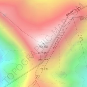
Name: Namcha Barwa topographic map, elevation, terrain.

Location: Namcha Barwa, Mainling City, Nyingchi Prefecture, Tibet, 860000, China (29.63124 95.05486 29.63134 95.05496)

Average elevation: 6,698 m

Minimum elevation: 5,256 m

Maximum elevation: 7,659 m

Other topographic maps

Click on a map to view its topography, its elevation and its terrain.

Pé Township

China > Tibet > Mainling City

Average elevation: 4,078 m

Tamnyen

China > Tibet > Mainling City

Average elevation: 3,868 m

Gear up for your next adventure:

🧤Thermal Hiking Gloves - Grip-enhanced gloves for cold-weather altitude trekking
🧭GPS Tracker - Track your location in remote areas safely
🛌Down Sleeping Bag - Superior warmth-to-weight ratio for cold nights
🧦Hiking Liner Socks - Thin base layer to prevent friction and blisters
🚲MTB Frame Bag - Carry tools and maps directly on your bicycle frame

As an Amazon Associate, this site earns from qualifying purchases at no extra cost to you.