Geolocate

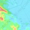
Ropa topographic map

Click on the map to display elevation.

About this map

Name: Ropa topographic map, elevation, terrain.

Location: Ropa, Općina Mljet, Dubrovnik-Neretva County, Croatia (42.74496 17.43431 42.75851 17.49022)

Average elevation: 78 m

Minimum elevation: -1 m

Maximum elevation: 328 m

Other topographic maps

Click on a map to view its topography, its elevation and its terrain.
Bosanka

Croatia > Dubrovnik-Neretva County > Dubrovnik

Average elevation: 156 m

Nuga

Croatia > Dubrovnik-Neretva County > Borovci

Average elevation: 173 m

Obalj

Croatia > Dubrovnik-Neretva County > Dubrovnik

Average elevation: 376 m

Gradina

Croatia > Dubrovnik-Neretva County

Average elevation: 28 m

Orašac

Croatia > Dubrovnik-Neretva County > Dubrovnik

Average elevation: 115 m

Matijevići

Croatia > Dubrovnik-Neretva County

Average elevation: 49 m

Katani

Croatia > Dubrovnik-Neretva County > Babino Polje

Average elevation: 224 m

Radalj

Croatia > Dubrovnik-Neretva County > Klek

Average elevation: 100 m

Prijevor

Croatia > Dubrovnik-Neretva County > Dubrovnik

Average elevation: 248 m

Prižba

Croatia > Dubrovnik-Neretva County

Average elevation: 88 m

Lenga

Croatia > Dubrovnik-Neretva County > Lovište

Average elevation: 5 m

Tršić

Croatia > Dubrovnik-Neretva County > Ošlje

Average elevation: 405 m

Gear up for your next adventure:

🎒Fully Waterproof Backpack - Total protection for photography gear and electronics
🧢Hiking Sun Hat - Wide-brimmed protection for exposed mountain ridges
🥾Trekking Boots - Durable boots for long-distance trekking
🔋Emergency Crank Radio - Weather alerts and power without needing batteries
🔋Lithium AA Batteries - Long-lasting power that performs in extreme cold

As an Amazon Associate, this site earns from qualifying purchases at no extra cost to you.