Geolocate

Bosanka topographic map

Click on the map to display elevation.

About this map

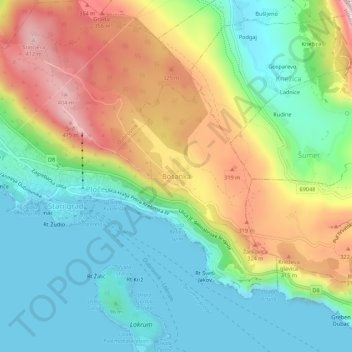
Name: Bosanka topographic map, elevation, terrain.

Location: Bosanka, Dubrovnik, Dubrovnik-Neretva County, 20108, Croatia (42.62441 18.10611 42.66441 18.14611)

Average elevation: 156 m

Minimum elevation: -2 m

Maximum elevation: 424 m

Other topographic maps

Click on a map to view its topography, its elevation and its terrain.

Gear up for your next adventure:

🧢Sun Hat - Wide-brim hat for sun protection
🧢Sun Protection Cap - Breathable cap to protect from sun exposure
🧦Thermal Socks - Warm socks for winter hiking or camping
❄️Traction Ice Cleats - Slip-on spikes for icy trails and winter hiking
🧢Outdoor Cap - Protective cap for sun and rain during hikes

As an Amazon Associate, this site earns from qualifying purchases at no extra cost to you.