
Make a donation
Gear up for your next adventure:
As an Amazon Associate, this site earns from qualifying purchases at no extra cost to you.
Kinzers topographic map
Click on the map to display elevation.
Make a donation
Gear up for your next adventure:
As an Amazon Associate, this site earns from qualifying purchases at no extra cost to you.
About this map
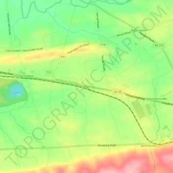
Name: Kinzers topographic map, elevation, terrain.
Average elevation: 143 m
Minimum elevation: 71 m
Maximum elevation: 231 m
Make a donation
Gear up for your next adventure:
As an Amazon Associate, this site earns from qualifying purchases at no extra cost to you.
Other topographic maps
Click on a map to view its topography, its elevation and its terrain.
Make a donation
Gear up for your next adventure:
As an Amazon Associate, this site earns from qualifying purchases at no extra cost to you.
Willow Street
United States > Pennsylvania > Lancaster County > West Lampeter Township
Pennsylvania Route 272 (Willow Street Pike) is the main highway through the community. It is split into two one-way streets, with the northbound lanes following the original main street through the town, and the southbound lanes running four blocks to the west. PA 272 leads north 4 miles (6 km) to the center…
Average elevation: 119 m
Make a donation
Gear up for your next adventure:
As an Amazon Associate, this site earns from qualifying purchases at no extra cost to you.
Indian Rocks
United States > Pennsylvania > Lancaster County > East Cocalico Township
Average elevation: 161 m
Gap
United States > Pennsylvania > Lancaster County
Gap is in eastern Lancaster County, in the southern part of Salisbury Township. A small portion of the community extends south into Sadsbury Township. The gap for which the community is named is at an elevation of 580 feet (180 m) above sea level, between Mine Ridge to the west and Gap Hill to the east, both…
Average elevation: 169 m
Paradise
United States > Pennsylvania > Lancaster County > Paradise Township > Paradise
Average elevation: 122 m
Make a donation
Gear up for your next adventure:
As an Amazon Associate, this site earns from qualifying purchases at no extra cost to you.