
Etah topographic map
Interactive map
Click on the map to display elevation.
About this map
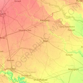
Name: Etah topographic map, elevation, terrain.
Location: Etah, Uttar Pradesh, India (27.32324 78.17557 27.78521 79.27717)
Average elevation: 168 m
Minimum elevation: 136 m
Maximum elevation: 201 m
Other topographic maps
Click on a map to view its topography, its elevation and its terrain.
Lucknow
India > Uttar Pradesh > Lucknow
Lucknow, Lucknow District, Uttar Pradesh, 226027, India
Average elevation: 120 m
Faizabad
Faizabad, Ayodhya District, Uttar Pradesh, 224188, India
Average elevation: 101 m
Shikarpur
Shikarpur, Bulandshahr District, Uttar Pradesh, India
Average elevation: 195 m
Bilaspur
Bilaspur, Rampur District, Uttar Pradesh, India
Average elevation: 195 m
Nizamabad
Nizamabad, Azamgarh, Uttar Pradesh, 276305, India
Average elevation: 81 m
Ghaziabad
India > Uttar Pradesh > Ghaziabad District
Ghaziabad, Ghaziabad District, Uttar Pradesh, India
Average elevation: 213 m
Gairaha
India > Uttar Pradesh > Gairaha
Gairaha, Mauranipur, Jhansi, Uttar Pradesh, India
Average elevation: 225 m
Beel Akbarpur
India > Uttar Pradesh > Beel Akbarpur
Beel Akbarpur, Ghaziabad, Uttar Pradesh, 201314, India
Average elevation: 208 m
Balrampur
India > Uttar Pradesh > Balrampur
Balrampur, Uttar Pradesh, 271200, India
Average elevation: 107 m
Kaushambi
India > Uttar Pradesh > Noida
Kaushambi, Noida, Ghaziabad, Uttar Pradesh, 201301, India
Average elevation: 205 m
Mountains
Mountains, Kānpur, Kanpur Dehat, Uttar Pradesh, India
Average elevation: 135 m
Sarnath
India > Uttar Pradesh > Sarnath
Sarnath, Vārānasi, Varanasi, Uttar Pradesh, 221007, India
Average elevation: 78 m
Ganges
India > Uttar Pradesh > Ghazipur
Ganges, Ghazipur, Uttar Pradesh, 233001, India
Average elevation: 1,626 m