Geolocate

Fanagmore topographic map

Click on the map to display elevation.

About this map

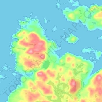
Name: Fanagmore topographic map, elevation, terrain.

Location: Fanagmore, Highland, Scotland, IV27 4ST, United Kingdom (58.37881 -5.14220 58.41881 -5.10220)

Average elevation: 35 m

Minimum elevation: 0 m

Maximum elevation: 133 m

Gear up for your next adventure:

🕶️Polarized Sunglasses - Protect your eyes with durable polarized lenses
🧤Insulated Winter Gloves - Heavy-duty protection for sub-zero Canadian adventures
🥾Light Hiking Boots - Lightweight and comfortable boots for day hikes
🥫Freeze-Dried Meals - Lightweight, high-calorie nutrition for multi-day treks
🎒Fully Waterproof Backpack - Total protection for photography gear and electronics

As an Amazon Associate, this site earns from qualifying purchases at no extra cost to you.