Geolocate

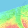
El Gorah topographic map

Click on the map to display elevation.

About this map

Name: El Gorah topographic map, elevation, terrain.

Location: El Gorah, North Sinai, Egypt (31.10808 34.14247 31.14808 34.18247)

Average elevation: 87 m

Minimum elevation: 76 m

Maximum elevation: 110 m

Other topographic maps

Click on a map to view its topography, its elevation and its terrain.

Lake Bardawil

Egypt > North Sinai

Average elevation: 37 m

Lake Bardawil

Egypt > North Sinai

Average elevation: 37 m

El Arish

Egypt > North Sinai

Average elevation: 29 m

El Arish

Egypt > North Sinai

Average elevation: 29 m

Lake Bardawil

Egypt > North Sinai

Average elevation: 37 m

El Arish

Egypt > North Sinai

Average elevation: 31 m

Gear up for your next adventure:

🛰️Satellite Messenger - Emergency communication for areas with no cell service
🥾Trail Hiking Boots - Supportive boots for rough trails
☕Camping Coffee Maker - Brew fresh coffee anywhere on the topographic map
🕯️Camping Lantern - Illuminates your entire campsite with high-efficiency LEDs
🪑Ultralight Camping Stool - Compact seating for rest stops during long hikes

As an Amazon Associate, this site earns from qualifying purchases at no extra cost to you.