

El Arish topographic map
Click on the map to display elevation.
About this map
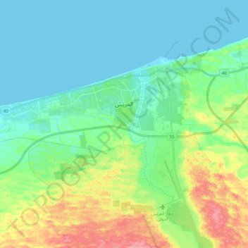
Name: El Arish topographic map, elevation, terrain.
Location: El Arish, North Sinai, Egypt (31.05800 33.67675 31.16168 33.86818)
Average elevation: 29 m
Minimum elevation: -1 m
Maximum elevation: 115 m
Other topographic maps
Click on a map to view its topography, its elevation and its terrain.

Nekhel
Nikhel (Arabic: نِخِل; also spelled and pronounced Nikhl) is administratively a city and the capital of the eponymous markaz (county) North Sinai Governorate, Egypt. It is located in the heart of the Sinai Peninsula bordered to its south by the South Sinai Governorate, and is bordered from the west by the…
Average elevation: 439 m


Nekhel
Nikhel (Arabic: نِخِل ; also spelled and pronounced Nikhl ) is administratively a city (though realistically more of a town) and the capital of the eponymous markaz (county) North Sinai Governorate, Egypt. It is located in the heart of the Sinai Peninsula bordered to its south by the South Sinai…
Average elevation: 439 m

