Geolocate

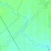
Tunnel Spring No. 2 topographic map

Click on the map to display elevation.

About this map

Name: Tunnel Spring No. 2 topographic map, elevation, terrain.

Location: Tunnel Spring No. 2, Tunnel Springs Rd, Box Elder County, Utah, United States (41.24878 -113.98042 41.24888 -113.98032)

Average elevation: 1,738 m

Minimum elevation: 1,593 m

Maximum elevation: 2,066 m

Other topographic maps

Click on a map to view its topography, its elevation and its terrain.
Brigham City

United States > Utah > Box Elder County

According to the United States Census Bureau, the city has a total area of 24.2 square miles (62.6 km2), of which 23.8 square miles (61.7 km2) is land and 0.35 square miles (0.9 km2), or 1.40%, is water. It lies at an elevation of 4,315 feet (1,315 m).

Average elevation: 1,529 m
Willard

United States > Utah > Box Elder County

Average elevation: 1,484 m

Elwood

United States > Utah > Box Elder County

Average elevation: 1,304 m

Plymouth

United States > Utah > Box Elder County

Average elevation: 1,391 m

Tremonton

United States > Utah > Box Elder County

Average elevation: 1,333 m

Duck Lake

United States > Utah > Box Elder County

Average elevation: 1,287 m

Garland

United States > Utah > Box Elder County

Average elevation: 1,322 m

Perry

United States > Utah > Box Elder County

Average elevation: 1,429 m

Hansel Mountains

United States > Utah > Box Elder County

Located in northeast Box Elder County, the southwest of the range abuts the Locomotive Springs State Wildlife Management Area; the northeast end of the range ends at a lower elevation divide between the North Hansel Mountains that lie on the Utah-Idaho border. Snowville lies on Deep Creek in the Sage Valley to…

Average elevation: 1,472 m

Mantua

United States > Utah > Box Elder County

Average elevation: 1,719 m

Tremonton

United States > Utah > Box Elder County

Average elevation: 1,333 m

Corinne

United States > Utah > Box Elder County

Average elevation: 1,288 m

Brigham City

United States > Utah > Box Elder County

According to the United States Census Bureau, the city has a total area of 24.2 square miles (62.6 km2), of which 23.8 square miles (61.7 km2) is land and 0.35 square miles (0.9 km2), or 1.40%, is water. It lies at an elevation of 4,315 feet (1,315 m).

Average elevation: 1,529 m
Malad River

United States > Utah > Box Elder County

Average elevation: 1,295 m

Tremonton

United States > Utah > Box Elder County

Average elevation: 1,333 m

Fielding

United States > Utah > Box Elder County

Average elevation: 1,329 m

Gear up for your next adventure:

🪑Ultralight Camping Stool - Compact seating for rest stops during long hikes
🛶Waterproof Dry Bags - Keep electronics and clothes dry during river crossings
🧥Thermal Layer - Insulating layer for cold outdoor conditions
👖Convertible Hiking Pants - Zip-off legs to adapt to changing weather conditions
🕯️Camping Lantern - Illuminates your entire campsite with high-efficiency LEDs

As an Amazon Associate, this site earns from qualifying purchases at no extra cost to you.