Geolocate

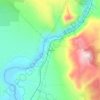
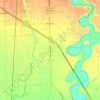
Duck Lake topographic map

Click on the map to display elevation.

About this map

Name: Duck Lake topographic map, elevation, terrain.

Location: Duck Lake, Box Elder County, Utah, United States (41.57793 -112.30180 41.58470 -112.27509)

Average elevation: 1,287 m

Minimum elevation: 1,278 m

Maximum elevation: 1,293 m

Other topographic maps

Click on a map to view its topography, its elevation and its terrain.
Bradford

United States > Utah > Box Elder County

Average elevation: 1,297 m

Brigham City

United States > Utah > Box Elder County

According to the United States Census Bureau, the city has a total area of 24.2 square miles (62.6 km2), of which 23.8 square miles (61.7 km2) is land and 0.35 square miles (0.9 km2), or 1.40%, is water. It lies at an elevation of 4,315 feet (1,315 m).

Average elevation: 1,529 m
Willard

United States > Utah > Box Elder County

Average elevation: 1,484 m

Elwood

United States > Utah > Box Elder County

Average elevation: 1,304 m

Plymouth

United States > Utah > Box Elder County

Average elevation: 1,391 m

Tremonton

United States > Utah > Box Elder County

Average elevation: 1,333 m

Garland

United States > Utah > Box Elder County

Average elevation: 1,322 m

Perry

United States > Utah > Box Elder County

Average elevation: 1,429 m

Hansel Valley

United States > Utah > Box Elder County

Average elevation: 1,462 m

Tunnel Spring No. 2

United States > Utah > Box Elder County

Average elevation: 1,738 m

Mantua

United States > Utah > Box Elder County

Average elevation: 1,719 m

Tremonton

United States > Utah > Box Elder County

Average elevation: 1,333 m

Corinne

United States > Utah > Box Elder County

Average elevation: 1,288 m

Brigham City

United States > Utah > Box Elder County

According to the United States Census Bureau, the city has a total area of 24.2 square miles (62.6 km2), of which 23.8 square miles (61.7 km2) is land and 0.35 square miles (0.9 km2), or 1.40%, is water. It lies at an elevation of 4,315 feet (1,315 m).

Average elevation: 1,529 m
Wheelon

United States > Utah > Box Elder County

Average elevation: 1,455 m

Tunnel Spring No. 2

United States > Utah > Box Elder County

Average elevation: 1,738 m

Tremonton

United States > Utah > Box Elder County

Average elevation: 1,333 m

Fielding

United States > Utah > Box Elder County

Average elevation: 1,329 m

Gear up for your next adventure:

🥫Freeze-Dried Meals - Lightweight, high-calorie nutrition for multi-day treks
🧣Evaporative Cooling Towel - Beat the heat during intense summer climbs
🥾Mountaineering Boots - Supportive boots for climbing and high-altitude hiking
🧢Sun Protection Cap - Breathable cap to protect from sun exposure
🪑Insulated Seat Pad - Protect your seat from cold rocks and wet logs

As an Amazon Associate, this site earns from qualifying purchases at no extra cost to you.