Geolocate

Oberau topographic map

Click on the map to display elevation.

About this map

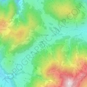
Name: Oberau topographic map, elevation, terrain.

Location: Oberau, Wildschönau, Bezirk Kufstein, Tyrol, 6311, Austria (47.42416 12.03263 47.46416 12.07263)

Average elevation: 1,102 m

Minimum elevation: 747 m

Maximum elevation: 1,725 m

Gear up for your next adventure:

🥾Waterproof Hiking Boots - Essential footwear for rugged terrain and wet Canadian trails
🧥Ultralight Puffy Jacket - Maximum warmth that packs down to the size of an orange
💧Filtered Water Bottle - Safe drinking water on the go
Tent Footprint - Protect tent floor and increase durability
🧦Merino Wool Socks - Moisture-wicking comfort for long-distance hiking

As an Amazon Associate, this site earns from qualifying purchases at no extra cost to you.