Geolocate

Back topographic map

Click on the map to display elevation.

About this map

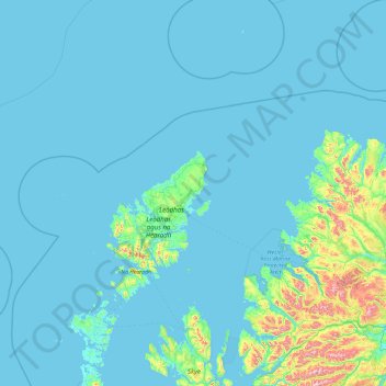
Name: Back topographic map, elevation, terrain.

Location: Back, Coll, Western Isles, Scotland, HS2 0LD, United Kingdom (57.28303 -7.31284 59.28303 -5.31284)

Average elevation: 59 m

Minimum elevation: 0 m

Maximum elevation: 1,126 m

Gear up for your next adventure:

🗺️Topographic Maps - Detailed maps to explore trails, mountains, and wilderness areas
🧦Outdoor Socks - Durable socks designed for hiking and outdoor sports
🥘Camping Cookware Set - Compact nesting pots and pans for trail cooking
💡LED Camping Lantern - Illuminate your campsite with long-lasting lanterns
🏃Hydration Running Vest - Carry water and maps close to your body for speed

As an Amazon Associate, this site earns from qualifying purchases at no extra cost to you.