Geolocate

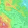
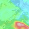
Karlovac topographic map

Click on the map to display elevation.

About this map

Name: Karlovac topographic map, elevation, terrain.

Location: Karlovac, Grad Karlovac, Karlovac County, Croatia (45.41990 15.48423 45.56468 15.63198)

Average elevation: 137 m

Minimum elevation: 101 m

Maximum elevation: 307 m

Other topographic maps

Click on a map to view its topography, its elevation and its terrain.

Zvonarci

Croatia > Karlovac County > Šišljavić

Average elevation: 108 m

Saint Gera

Croatia > Karlovac County > Grad Ozalj

At the top of Sveta Gera, at an altitude of 1178 meters, there is a telecommunication tower and a military barracks whose location is strategically important to Croatia. The barracks were used by the Yugoslav People's Army (JNA) until early 1991 when its soldiers withdrew from the site following breakup of…

Average elevation: 961 m

Kula

Croatia > Karlovac County > Jasenak

Average elevation: 1,226 m

Ogulin

Croatia > Karlovac County

Average elevation: 391 m

Rosići

Croatia > Karlovac County > Sjeničak Lasinjski

Average elevation: 236 m

Kamanje

Croatia > Karlovac County

Average elevation: 208 m

Ogulin

Croatia > Karlovac County

Average elevation: 391 m

Livade

Croatia > Karlovac County > Gornje Primišlje

Average elevation: 289 m

Gornje Primišlje

Croatia > Karlovac County > Grad Slunj

Average elevation: 286 m

Ozalj

Croatia > Karlovac County

Average elevation: 179 m

Gornji Furjan

Croatia > Karlovac County > Grad Slunj

Average elevation: 325 m

Gear up for your next adventure:

🔥Emergency Fire Starter - Reliable ignition source for all weather conditions
🧢Hiking Hat - Sun-protective and breathable hats for long treks
🥾All-Terrain Hiking Boots - Versatile boots for varied hiking conditions
⛺Family Camping Tent - Spacious tent suitable for family camping trips
🥾Mountain Trail Shoes - High-traction shoes for mountain trails

As an Amazon Associate, this site earns from qualifying purchases at no extra cost to you.