Geolocate

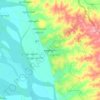
Pakokku District topographic map

Click on the map to display elevation.

About this map

Name: Pakokku District topographic map, elevation, terrain.

Location: Pakokku District, Magway, Myanmar (20.83708 94.26470 21.87255 95.34202)

Average elevation: 253 m

Minimum elevation: 43 m

Maximum elevation: 1,436 m

Other topographic maps

Click on a map to view its topography, its elevation and its terrain.

Kyi Gyi

Myanmar > Magway > Magway District

Average elevation: 62 m

Yenangyaung

Myanmar > Magway > Magway District

Average elevation: 73 m

Swedon

Myanmar > Magway > Aunglan Township

Average elevation: 166 m

Pa Daing Gyon

Myanmar > Magway > Pakokku District

Average elevation: 100 m

Taungdwingyi

Myanmar > Magway > Magway District

Average elevation: 141 m

Pindale

Myanmar > Magway > Seikphyu Township

Average elevation: 81 m

Sin Htoe

Myanmar > Magway > Gangaw District

Average elevation: 405 m

Thanat

Myanmar > Magway > Thayet District > Aunglan Township > Thanat

Average elevation: 104 m

Gear up for your next adventure:

🏕️Camping Hammock - Integrated protection for sleeping between trees
🥾Hiking Shorts - Breathable shorts suitable for summer hikes
🥾Trail Hiking Socks - Comfortable socks to prevent blisters and fatigue
🧣Merino Neck Gaiter - Protects against wind, sun, and cold at high altitudes
🦶Hiking Shoe Insoles - Added support for high arches and long days on feet

As an Amazon Associate, this site earns from qualifying purchases at no extra cost to you.