Geolocate

Swedon topographic map

Click on the map to display elevation.

About this map

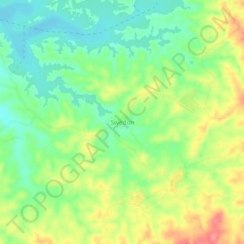
Name: Swedon topographic map, elevation, terrain.

Location: Swedon, Aunglan Township, Thayet District, Magway, Myanmar (19.17136 95.62205 19.21136 95.66205)

Average elevation: 166 m

Minimum elevation: 133 m

Maximum elevation: 211 m

Gear up for your next adventure:

🧥Softshell Hiking Jacket - The perfect balance of wind protection and breathability
🏃Hydration Running Vest - Carry water and maps close to your body for speed
🗺️Topographic Maps - Detailed maps to explore trails, mountains, and wilderness areas
🥾Mountain Trail Shoes - High-traction shoes for mountain trails
🚲Bike Repair Kit - Essential tools for on-trail mechanical issues

As an Amazon Associate, this site earns from qualifying purchases at no extra cost to you.