Geolocate

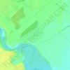
Domnești topographic map

Click on the map to display elevation.

About this map

Name: Domnești topographic map, elevation, terrain.

Location: Domnești, Ilfov, Romania (44.36336 25.85605 44.43723 25.97629)

Average elevation: 90 m

Minimum elevation: 75 m

Maximum elevation: 104 m

Other topographic maps

Click on a map to view its topography, its elevation and its terrain.
Odăile

Romania > Ilfov > Otopeni

Average elevation: 96 m

Petrești

Romania > Ilfov

Average elevation: 98 m

Fundeni - Dobroești

Romania > Ilfov

Average elevation: 77 m

Ciofliceni

Romania > Ilfov

Average elevation: 95 m

Lacul Morii

Romania > Ilfov > Bucharest

Average elevation: 85 m

Dragomirești-Deal

Romania > Ilfov

Average elevation: 96 m

Odăile

Romania > Ilfov > Otopeni

Average elevation: 96 m

Căciulați

Romania > Ilfov

Average elevation: 90 m

Dumitrana

Romania > Ilfov > Măgurele

Average elevation: 72 m

Rudeni

Romania > Ilfov > Chitila

Average elevation: 93 m

Islaz

Romania > Ilfov

Average elevation: 73 m

Ghermănești

Romania > Ilfov

Average elevation: 94 m

Căciulați

Romania > Ilfov

Average elevation: 90 m

Ordoreanu

Romania > Ilfov

Average elevation: 86 m

Moara Vlăsiei

Romania > Ilfov > Moara Vlăsiei

Average elevation: 87 m

Snagov

Romania > Ilfov > Snagov

Average elevation: 92 m

Gear up for your next adventure:

🧢Outdoor Cap - Protective cap for sun and rain during hikes
❄️Traction Ice Cleats - Slip-on spikes for icy trails and winter hiking
🏃Hydration Running Vest - Carry water and maps close to your body for speed
🥾Waterproof Hiking Boots - Essential footwear for rugged terrain and wet Canadian trails
🧴Outdoor Sunscreen - High SPF protection for high-altitude UV exposure

As an Amazon Associate, this site earns from qualifying purchases at no extra cost to you.