

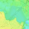
Ordoreanu topographic map
Click on the map to display elevation.
About this map

Name: Ordoreanu topographic map, elevation, terrain.
Location: Ordoreanu, Clinceni, Ilfov, 077062, Romania (44.34387 25.87344 44.38387 25.91344)
Average elevation: 86 m
Minimum elevation: 78 m
Maximum elevation: 95 m
Other topographic maps
Click on a map to view its topography, its elevation and its terrain.




Mogoșoaia
The commune is situated in the Wallachian Plain, at an altitude of 95 m (312 ft), on the banks of the Colentina River, which widens here into the Lake Mogoșoaia [ro]. It is located in the central-west part of Ilfov County, in the northwestern outskirts of the national capital, about 16 km (9.9 mi) from…
Average elevation: 98 m


