Geolocate

Mit Rahinah topographic map

Click on the map to display elevation.

About this map

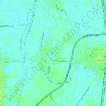
Name: Mit Rahinah topographic map, elevation, terrain.

Location: Mit Rahinah, Giza, 12921, Egypt (29.83377 31.23381 29.87377 31.27381)

Average elevation: 22 m

Minimum elevation: 18 m

Maximum elevation: 30 m

Other topographic maps

Click on a map to view its topography, its elevation and its terrain.

Giza Pyramids

Egypt > Giza > Giza

Average elevation: 65 m

Giza Pyramids

Egypt > Giza > Giza

Average elevation: 65 m

Giza Pyramids

Egypt > Giza > Giza

Average elevation: 65 m

Al Haraneya Village

Egypt > Giza

Average elevation: 19 m

Abo Al Nomros City

Egypt > Giza > Abu An Numrus

Average elevation: 20 m

Ard Al Lwaa'

Egypt > Giza > Nazlet Bahgat

Average elevation: 23 m

Kerdasa City

Egypt > Giza > Kirdasah

Average elevation: 28 m

City View

Egypt > Giza

Average elevation: 65 m

Al Mounib

Egypt > Giza

Average elevation: 22 m

Jazirat Warraq al Hadar

Egypt > Giza > Tanaash

Average elevation: 20 m

Ard Al Lwaa'

Egypt > Giza > Nazlet Bahgat

Average elevation: 23 m

Gezirat Dahab

Egypt > Giza

Average elevation: 21 m

Sheikh Zayed

Egypt > Giza

Average elevation: 122 m

Abu Sir

Egypt > Giza > Abu Sir

Average elevation: 44 m

Qursaya

Egypt > Giza > Giza

Average elevation: 23 m

El Hassana Dome Protectorate

Egypt > Giza > Sheikh Zayed

Average elevation: 108 m

Al Hosary park

Egypt > Giza > Sixth of October

Average elevation: 184 m

Gear up for your next adventure:

🥾Trail Hiking Shoes - Durable shoes designed for rugged trails
💧Filtered Water Bottle - Safe drinking water on the go
🥾Mountaineering Boots - Supportive boots for climbing and high-altitude hiking
Camping Groundsheet - Protect your tent from moisture and dirt
🥫Freeze-Dried Meals - Lightweight, high-calorie nutrition for multi-day treks

As an Amazon Associate, this site earns from qualifying purchases at no extra cost to you.