Geolocate

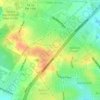
Saint Hedwig topographic map

Click on the map to display elevation.

About this map
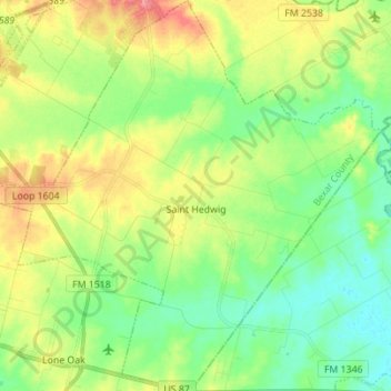
Name: Saint Hedwig topographic map, elevation, terrain.

Location: Saint Hedwig, Bexar County, Texas, 78152, United States (29.35815 -98.27311 29.47882 -98.13511)

Average elevation: 173 m

Minimum elevation: 145 m

Maximum elevation: 220 m

Other topographic maps

Click on a map to view its topography, its elevation and its terrain.
San Antonio

United States > Texas > Bexar County > San Antonio

Average elevation: 218 m

Sedona

United States > Texas > Bexar County > San Antonio

Average elevation: 301 m

Theis Hill

United States > Texas > Bexar County > San Antonio

Average elevation: 258 m

Mount Smith

United States > Texas > Bexar County

Average elevation: 515 m

Eldorado Lake

United States > Texas > Bexar County > San Antonio

Average elevation: 250 m

Gear up for your next adventure:

🧳Compression Sacks - Maximize space in your backpack by shrinking gear
💧Hydration Pack - Hands-free hydration system for long hikes
🛏️Sleeping Bag - Warm and compact sleeping bags for outdoor camping
🧊Portable Cooler - Keep food and drinks cold during outdoor adventures
🧥Softshell Jacket - Windproof and breathable jacket for hiking

As an Amazon Associate, this site earns from qualifying purchases at no extra cost to you.