Geolocate

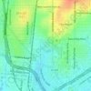
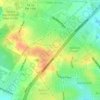
Comanche Lookout topographic map

Click on the map to display elevation.

About this map

Name: Comanche Lookout topographic map, elevation, terrain.

Location: Comanche Lookout, San Antonio, Bexar County, Texas, 78233, United States (29.58479 -98.36781 29.58489 -98.36771)

Average elevation: 284 m

Minimum elevation: 259 m

Maximum elevation: 316 m

Other topographic maps

Click on a map to view its topography, its elevation and its terrain.
Sedona

United States > Texas > Bexar County > San Antonio

Average elevation: 301 m

Eldorado Lake

United States > Texas > Bexar County > San Antonio

Average elevation: 250 m

Gear up for your next adventure:

💧Hydration Bladder - Hands-free hydration solution for long treks
🥾Waterproof Trail Shoes - Shoes designed to handle wet terrain
🦶Anti-Blister Balm - Prevents friction and hotspots during long ascents
🧭GPS Handheld Device - Reliable GPS navigation for outdoor adventures
🩹Moleskin Blister Pads - Direct protection for painful foot pressure points

As an Amazon Associate, this site earns from qualifying purchases at no extra cost to you.