Geolocate

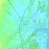
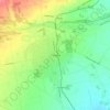
Rangiora topographic map

Click on the map to display elevation.

About this map

Name: Rangiora topographic map, elevation, terrain.

Location: Rangiora, Waimakariri District, Canterbury, 7400, New Zealand (-43.34403 172.55931 -43.28033 172.62556)

Average elevation: 27 m

Minimum elevation: 2 m

Maximum elevation: 58 m

Other topographic maps

Click on a map to view its topography, its elevation and its terrain.
Ohoka

New Zealand > Canterbury > Waimakariri District

Average elevation: 22 m

Cust

New Zealand > Canterbury > Waimakariri District

Average elevation: 133 m

Oxford

New Zealand > Canterbury > Waimakariri District

Average elevation: 255 m

Gear up for your next adventure:

🧤Insulated Winter Gloves - Heavy-duty protection for sub-zero Canadian adventures
💡LED Headlamp - Hands-free illumination for night hiking and camping
🧊Insulated Water Bottle - Keeps drinks cold in summer and prevents freezing in winter
🚲MTB Frame Bag - Carry tools and maps directly on your bicycle frame
🥾Hiking Gaiters - Protect legs and shoes from mud, snow, and debris

As an Amazon Associate, this site earns from qualifying purchases at no extra cost to you.