Geolocate

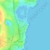
Tortoman topographic map

Click on the map to display elevation.

About this map

Name: Tortoman topographic map, elevation, terrain.

Location: Tortoman, Constanța, Romania (44.30533 28.16636 44.41411 28.34507)

Average elevation: 75 m

Minimum elevation: 12 m

Maximum elevation: 127 m

Other topographic maps

Click on a map to view its topography, its elevation and its terrain.

Făclia

Romania > Constanța

Average elevation: 44 m

Vadu

Romania > Constanța

Average elevation: 13 m

Vama Veche

Romania > Constanța

Average elevation: 11 m

Eforie Nord

Romania > Constanța

Average elevation: 11 m

Cogealac

Romania > Constanța

Average elevation: 97 m

Dobrogea

Romania > Constanța > Grădina

Except for the Danube Delta, a marshy region located in its northeastern corner, Dobruja is hilly, with an average altitude of about 200–300 metres. The highest point is the Țuțuiatu (Greci) Peak in the Măcin Mountains, having a height of 467 m. The Dobruja Plateau covers most of the Romanian part of…

Average elevation: 53 m
Constanța

Romania > Constanța > Constanța

Average elevation: 18 m

Movile Cave

Romania > Constanța > Mangalia

Average elevation: 25 m

Mamaia-Sat

Romania > Constanța > Năvodari

Average elevation: 7 m

Mamaia

Romania > Constanța > Constanța

Average elevation: 2 m

Neptun

Romania > Constanța > Mangalia

Average elevation: 12 m

Saturn

Romania > Constanța > Mangalia

Average elevation: 8 m

Pietreni

Romania > Constanța

Average elevation: 122 m

Gear up for your next adventure:

🧊Insulated Water Bottle - Keeps drinks cold in summer and prevents freezing in winter
🧥Fleece Jacket - Warm and lightweight jacket for layering
🧦Hiking Liner Socks - Thin base layer to prevent friction and blisters
🧥Waterproof Pants - Keep dry during rainy hiking conditions
🛶Kayak Dry Bag - Waterproof storage for kayaking adventures

As an Amazon Associate, this site earns from qualifying purchases at no extra cost to you.