Geolocate

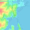
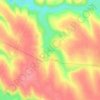
Cogealac topographic map

Click on the map to display elevation.

About this map

Name: Cogealac topographic map, elevation, terrain.

Location: Cogealac, Constanța, 907070, Romania (44.54921 28.53899 44.57654 28.57729)

Average elevation: 97 m

Minimum elevation: 64 m

Maximum elevation: 136 m

Other topographic maps

Click on a map to view its topography, its elevation and its terrain.
Constanța

Romania > Constanța

Spring arrives early but it is quite cool. Often in April and May the Black Sea coast is one of the coolest places in Romania found at an altitude lower than 500 m (1,640 ft).

Average elevation: 19 m

Făclia

Romania > Constanța

Average elevation: 44 m

Topalu

Romania > Constanța

Average elevation: 70 m

Cogealac

Romania > Constanța

Average elevation: 105 m

Baneasa

Romania > Constanța

Average elevation: 130 m

Vama Veche

Romania > Constanța

Average elevation: 11 m

Cernavoda

Romania > Constanța

Average elevation: 39 m

Dumbrăveni

Romania > Constanța

Average elevation: 160 m

Eforie Nord

Romania > Constanța

Average elevation: 11 m

Dobrogea

Romania > Constanța > Grădina

Except for the Danube Delta, a marshy region located in its northeastern corner, Dobruja is hilly, with an average altitude of about 200–300 metres. The highest point is the Țuțuiatu (Greci) Peak in the Măcin Mountains, having a height of 467 m. The Dobruja Plateau covers most of the Romanian part of…

Average elevation: 53 m

Constanța

Romania > Constanța

Spring arrives early but it is quite cool. Often in April and May the Black Sea coast is one of the coolest places in Romania found at an altitude lower than 500 m (1,640 ft).

Average elevation: 19 m

Cobadin

Romania > Constanța

Average elevation: 114 m

Cernavoda

Romania > Constanța

Average elevation: 39 m

Ion Corvin

Romania > Constanța

Average elevation: 94 m

Mangalia

Romania > Constanța

Average elevation: 18 m

Costinești

Romania > Constanța

Average elevation: 28 m

Constanța

Romania > Constanța

Spring arrives early but it is quite cool. Often in April and May the Black Sea coast is one of the coolest places in Romania found at an altitude lower than 500 m (1,640 ft).

Average elevation: 19 m

Cumpăna

Romania > Constanța

Average elevation: 53 m

Corbu

Romania > Constanța

Average elevation: 37 m

Movile Cave

Romania > Constanța > Mangalia

Average elevation: 25 m

Mamaia-Sat

Romania > Constanța > Năvodari

Average elevation: 7 m

Techirghiol

Romania > Constanța

Town is in the south east extremity of Romania (Constanța County), situated on the north west shore of Lake Techirghiol (11.6 km2), elevation 15–20 m, 18 km south of the municipality of Constanța and very close to the Black Sea (3 km).

Average elevation: 23 m

Mangalia

Romania > Constanța

Mangalia is positioned at 43°49’ latitude and 28°35’ longitude, with an approximate elevation of 10 meters, 44 kilometres (27 miles) south of the municipality of Constanţa, on the same latitude as the French resort of Nice. Mangalia is one of the southernmost resorts on the Romanian coast of the Black Sea.

Average elevation: 18 m

Constanța

Romania > Constanța

Spring arrives early but it is quite cool. Often in April and May the Black Sea coast is one of the coolest places in Romania found at an altitude lower than 500 m (1,640 ft).

Average elevation: 19 m

Mihail Kogălniceanu

Romania > Constanța

Average elevation: 80 m

Constanța

Romania > Constanța

Spring arrives early but it is quite cool. Often in April and May the Black Sea coast is one of the coolest places in Romania found at an altitude lower than 500 m (1,640 ft).

Average elevation: 19 m

Neptun

Romania > Constanța > Mangalia

Average elevation: 12 m

Constanța

Romania > Constanța

Spring arrives early but it is quite cool. Often in April and May the Black Sea coast is one of the coolest places in Romania found at an altitude lower than 500 m (1,640 ft).

Average elevation: 31 m

Săcele

Romania > Constanța

Average elevation: 57 m

Tortoman

Romania > Constanța

Average elevation: 75 m

Cernavoda

Romania > Constanța

Average elevation: 39 m

Eforie

Romania > Constanța

Average elevation: 9 m

Amzacea

Romania > Constanța

Average elevation: 86 m

Tortoman

Romania > Constanța

Average elevation: 75 m

Ovidiu

Romania > Constanța

Average elevation: 38 m

Eforie

Romania > Constanța

Average elevation: 9 m

Medgidia

Romania > Constanța

Average elevation: 67 m

Saturn

Romania > Constanța > Mangalia

Average elevation: 8 m

Topraisar

Romania > Constanța

Average elevation: 76 m

Harsova

Romania > Constanța

Average elevation: 16 m

Pietreni

Romania > Constanța

Average elevation: 122 m

Gear up for your next adventure:

🪑Ultralight Camping Stool - Compact seating for rest stops during long hikes
🧦Merino Wool Socks - Moisture-wicking comfort for long-distance hiking
🛰️Satellite Messenger - Emergency communication for areas with no cell service
🧥Thermal Fleece Jacket - Versatile insulation for changing mountain temperatures
🔦LED Headtorch - Bright and durable light for night activities

As an Amazon Associate, this site earns from qualifying purchases at no extra cost to you.