
Millport topographic map
Click on the map to display elevation.
About this map
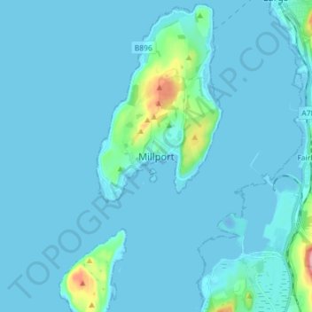
Name: Millport topographic map, elevation, terrain.
Location: Millport, North Ayrshire, Scotland, KA28 0DL, United Kingdom (55.71396 -4.96398 55.79396 -4.88398)
Average elevation: 11 m
Minimum elevation: -13 m
Maximum elevation: 162 m
Other topographic maps
Click on a map to view its topography, its elevation and its terrain.
Isle of Arran
United Kingdom > Scotland > North Ayrshire
The island has three endemic species of tree, the Arran whitebeams. These trees are the Scottish or Arran whitebeam (Sorbus arranensis), the bastard mountain ash or cut-leaved whitebeam (Sorbus pseudofennica) and the Catacol whitebeam (Sorbus pseudomeinichii). If rarity is measured by numbers alone they are…
Average elevation: 98 m