
North Georgetown topographic map
Click on the map to display elevation.
About this map
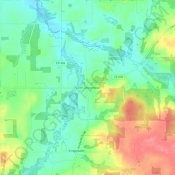
Name: North Georgetown topographic map, elevation, terrain.
Average elevation: 357 m
Minimum elevation: 327 m
Maximum elevation: 405 m
Other topographic maps
Click on a map to view its topography, its elevation and its terrain.
Highlandtown Lake Dam
United States > Ohio > Columbiana County > Highlandtown
Average elevation: 344 m
Summitville
United States > Ohio > Columbiana County
Summitville was laid out in 1853. The village was so named on account of its lofty elevation near one of the highest points between the Sandy Creek and Lake Erie.
Average elevation: 351 m